Modern geoinformation solutions

- Описание
Ark-on focuses on creating geoinformation systems, carrying out topographical surveys and the processing of engineering and construction associated data, such as oil and gas pipe-lines, roads, railways and power lines.
The formation of precise digital cartographical information.
Our core business activities involve the creation of digital elevation models, digital orthophotoes, digital terrain models and digital topographic plans at scales 1:1000 – 1:5000. These materials are produced using a number of technologies and techniques, including airborne laser scanning and digital aerial surveys.
The creation of precise digital terrain models.
We have a great experience in creation of precise digital elevation models (DEM) and GIS datasets.
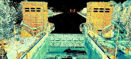
Our specialists successfully use the newest high precision methods, such as airborne, mobile and terrain laser scanning, and automated processing technologies. All this allows us to produce very high precise DTM, which couldn’t be provided by traditional geodetic methods.
Surveys for engineering and construction.
The optimal combination of traditional (tacheometry, GPS/GLONASS) and innovation (airborne, mobile and terrain laser scanning, georadar survey) methods and a lot of experience in data processing allow us to obtain high precision and speed of surveys.
Visualization of spatial data and GIS implementation.
Ark-on offers services in creation of systems of storage, analysis and visualization of digital cartographic products. This systems can be presented in the form of spatial databases, geoinformation systems or virtual models.
The main feature of GIS solutions, offered by Ark-on, is their flexibility. We create systems, which don’t need complicated hardware-software resources and are very easy to use.
Download the PowerPoint presentation
Contact us
Derbenevskaya naberezhnaya, 11, of. A-507, Moscow, 115114, Russiatel/fax:+7(495) 647-13-81
e-mail: infos@ark-on.ru
